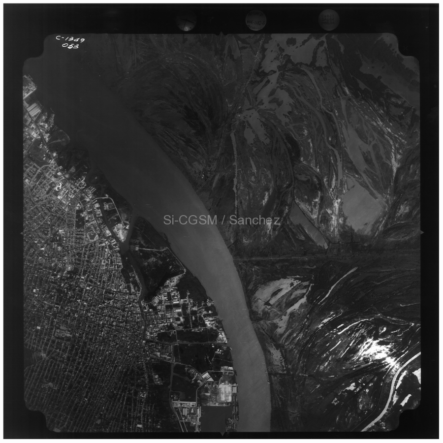
Ecorregión CGSMCGSM ecoregion
Un punto de entrada para conocer el territorio de la Ciénaga Grande de Santa Marta, sus delimitaciones y sus áreas especiales.An entry point to explore the territory of Ciénaga Grande de Santa Marta, its boundaries and its designated areas.
Ver en pantalla completaView full screen
El mapa de uMap permite consultar por separado la Ecorregión CGSM, la Vía Parque Isla de Salamanca, el Santuario de Flora y Fauna CGSM y el sitio Ramsar.The uMap map provides separate layers for the CGSM ecoregion, Vía Parque Isla de Salamanca, the CGSM Flora and Fauna Sanctuary and the Ramsar site.
Definición del área de estudioDefinition of the study area
Sí-CGSM adopta como marco territorial la definición de Pro-Ciénaga (CORPAMAG et al. 1993, 1995). Se extiende aproximadamente entre 10º20′–11º06′ N y 74º06′–74º52′ O. Sus límites son el mar al norte, la carretera Ciénaga–Fundación al este, una línea recta entre Fundación y Cerro San Antonio al sur y el río Magdalena al oeste.Sí-CGSM uses the Pro-Ciénaga definition as its territorial framework (CORPAMAG et al. 1993, 1995). It extends approximately between 10º20′–11º06′ N and 74º06′–74º52′ W. Its boundaries are the sea to the north, the Ciénaga–Fundación road to the east, a straight line between Fundación and Cerro San Antonio to the south, and the Magdalena River to the west.
Superficie del polígono representado: aproximadamente 4.136 km². El recálculo del 12 de octubre de 2026 mediante el área geodésica sobre el elipsoide WGS 84 (pyproj/PROJ) lo confirma. Esta superficie corresponde al perímetro digitalizado; no constituye una nueva delimitación oficial.Area of the mapped polygon: approximately 4,136 km². Recalculation on 12 October 2026 using geodesic area on the WGS 84 ellipsoid (pyproj/PROJ) confirms this. This area refers to the digitized boundary; it does not establish a new official boundary.
Áreas especialesDesignated areas
La ecorregión se superpone con diferentes figuras de protección y reconocimiento. Consulte sus páginas para conocer cada ámbito:The ecoregion overlaps with different protection and recognition designations. Visit their pages to explore each spatial unit:
Delimitaciones y criteriosBoundaries and criteria
Las fuentes emplean denominaciones, límites y superficies diferentes. La tabla reúne las cifras documentales y el recálculo actual del polígono de uMap para permitir su comparación; no presupone que todas las filas describan el mismo espacio ni el mismo método de medición.Sources use different names, boundaries and areas. The table brings together the reported figures and the current recalculation of the uMap polygon for comparison; it does not assume that all rows describe the same spatial unit or measurement method.
| Año | Referencia | Denominación | Latitud y Longitud | Área total (km2) | Espejo de agua (km2) [Mar] |
|---|---|---|---|---|---|
| 1993 | Corpamag et al. 1993 | Ecorregión CGSM | – | 4.280 | 680 |
| 1995 | Corpamag et al. 1995 | Ecorregión CGSM | 10º20′-11º05′ N 74º06′-74º52′ O | 4.000 | 730 |
| 1998 | Botero y Salzwedel 1999 (citando: Gónima et al. 1996) | Sistema estuarino y complejo lagunar CGSM | 10º40′-10º59′ N 74º15′-74º38′ O | – | 720 |
| 1999-2002 | Inf01 – 2002 | Llanura deltaica derecha del Río Magdalena | – | 4.900 | 730 [570] |
| 2004 | Garay et al. 2004 | Ecorregión CGSM | 10º20′-11º05′ N 74º06′-74º52′ O | – | – |
| 2003-2006 | Inf02 – 2003, Inf03 – 2004, Inf04 – 2005, Inf05 – 2006 | Ecorregión CGSM | 10°43’-11°00’ N 74°16’-74°38’ O | 1.280 | 450+120 |
| 2007-2014 | Inf06 – 2007, Inf07 – 2008, Inf08 – 2009, Inf09 – 2010, Inf10 – 2011, Inf11 – 2012, Inf12 – 2013, Inf13 – 2014 | Ecorregión CGSM; Sistema estuarino y complejo lagunar CGSM; La región de la CGSM | 10°43’-11°00’ N 74°16’-74°38’ O | 3.812 | 757 |
| 2015-2016 | Inf14 – 2015, Inf15 – 2016 | Sistema estuarino y complejo lagunar CGSM; Ecorregión CGSM | 10°44’ N 74º30′ O | 4.280 | 730 |
| 2017 – 2021 | Inf16 – 2017, Inf17 – 2018, Inf18 – 2019, Inf19 – 2020, Inf20 – 2021 | Ecorregión CGSM | 10.54505306 – 11.13278062 N 74.87842746 – 74.21323554 O | – | – |
| 2026 | Este trabajo (uMap; área geodésica, WGS 84) | Ecorregión CGSM | 10.329612–11.109011 N 74.096947–74.869251 O | 4.135,54 | ca. 680 en total: ca. 441 laguna principal, ca. 148 Complejo Pajarales*, ca. 92 otros cuerpos de agua |
| Year | Reference | Designation | Latitude and longitude | Total area (km2) | Water surface (km2) [Sea] |
|---|---|---|---|---|---|
| 1993 | Corpamag et al. 1993 | CGSM ecoregion | – | 4.280 | 680 |
| 1995 | Corpamag et al. 1995 | CGSM ecoregion | 10º20′-11º05′ N 74º06′-74º52′ O | 4.000 | 730 |
| 1998 | Botero y Salzwedel 1999 (citing: Gónima et al. 1996) | CGSM estuarine system and lagoon complex | 10º40′-10º59′ N 74º15′-74º38′ O | – | 720 |
| 1999-2002 | Inf01 – 2002 | Right-bank delta plain of the Magdalena River | – | 4.900 | 730 [570] |
| 2004 | Garay et al. 2004 | CGSM ecoregion | 10º20′-11º05′ N 74º06′-74º52′ O | – | – |
| 2003-2006 | Inf02 – 2003, Inf03 – 2004, Inf04 – 2005, Inf05 – 2006 | CGSM ecoregion | 10°43’-11°00’ N 74°16’-74°38’ O | 1.280 | 450+120 |
| 2007-2014 | Inf06 – 2007, Inf07 – 2008, Inf08 – 2009, Inf09 – 2010, Inf10 – 2011, Inf11 – 2012, Inf12 – 2013, Inf13 – 2014 | CGSM ecoregion; CGSM estuarine system and lagoon complex; The CGSM region | 10°43’-11°00’ N 74°16’-74°38’ O | 3.812 | 757 |
| 2015-2016 | Inf14 – 2015, Inf15 – 2016 | CGSM estuarine system and lagoon complex; CGSM ecoregion | 10°44’ N 74º30′ O | 4.280 | 730 |
| 2017 – 2021 | Inf16 – 2017, Inf17 – 2018, Inf18 – 2019, Inf19 – 2020, Inf20 – 2021 | CGSM ecoregion | 10.54505306 – 11.13278062 N 74.87842746 – 74.21323554 O | – | – |
| 2026 | This work (uMap; geodesic area, WGS 84) | CGSM ecoregion | 10.329612–11.109011 N 74.096947–74.869251 W | 4,135.54 | ≈ 680 total: ≈ 441 main lagoon, ≈ 148 Pajarales complex*, ≈ 92 other water bodies |
Estimación cartográfica sin mar: áreas geodésicas WGS 84 de polígonos OpenStreetMap (11.10.2026), recortados a la ecorregión y unidos sin duplicaciones. *Pajarales comprende diez cuerpos identificados (Pajaral, Pijiño, Cherle, Tigre, Conchal, Alfandoque, La Piedra, La Luna, Hachita y Machetico) según el Plan de Manejo Ramsar, pp. 42–43; no es un total exhaustivo del complejo. «Otros» es el resto; las cifras se redondean para la presentación.Cartographic estimate excluding the sea: WGS 84 geodesic areas of OpenStreetMap polygons (11 October 2026), clipped to the ecoregion and merged without double counting. *Pajarales comprises ten identified water bodies (Pajaral, Pijiño, Cherle, Tigre, Conchal, Alfandoque, La Piedra, La Luna, Hachita and Machetico), selected using the Ramsar Management Plan, pp. 42–43; it is not an exhaustive total for the complex. “Other” is the remainder; figures are rounded for presentation. OpenStreetMap / Geofabrik.
La laguna principal tiene ca. 441 km² según el cálculo geodésico WGS 84 del polígono de OpenStreetMap (relación 2170606), obtenido del extracto de Geofabrik con fecha de actualización 11 de octubre de 2026 (OpenStreetMap contributors, 2026). El recálculo del 18 de octubre da 441,35 km². La fecha del extracto identifica el estado de la base cartográfica, no una observación simultánea del agua; no se han determinado las fechas de adquisición de la línea de orilla utilizada.The main lagoon covers approximately 441 km² according to a WGS 84 geodesic calculation of the OpenStreetMap polygon (relation 2170606), obtained from the Geofabrik extract updated on 11 October 2026 (OpenStreetMap contributors, 2026). Recalculation on 18 October yields 441.35 km². The extract date identifies the state of the mapping database, not a simultaneous observation of water extent; the acquisition dates of the mapped shoreline have not been established.
Los 450 km² son un valor aproximado de larga tradición bibliográfica, documentado al menos desde Wiedemann (1973, p. 85) y utilizado por Bernal (1996, p. 27) y Botero y Salzwedel (1999, p. 244). INVEMAR-GEO (2015, p. 4) lo emplea al describir el área de estudio; INVEMAR–MADS–PNN (2017, tabla 3.2, p. 19) lo presenta como «área levantada» en 2015. Los informes consultados no documentan una nueva determinación independiente de esa superficie ni identifican su fuente original en ese pasaje. Las delimitaciones de 441 y 450 km² no se han homologado espacialmente: su diferencia no demuestra una reducción ni un aumento temporal del espejo de agua.The 450 km² figure is a longstanding approximate literature value, documented at least since Wiedemann (1973, p. 85) and used by Bernal (1996, p. 27) and Botero and Salzwedel (1999, p. 244). INVEMAR-GEO (2015, p. 4) uses it to describe the study area; INVEMAR–MADS–PNN (2017, Table 3.2, p. 19) lists it as the area surveyed in 2015. The reports examined do not document a new independent determination of that area or identify its original source in that passage. The 441 and 450 km² boundaries have not been spatially harmonised: their difference does not demonstrate a temporal decrease or increase in water extent.
Superficie y batimetría tienen fuentes distintas. Los 441 km² proceden de OSM, no de DIMAR. La carta DIMAR COL 1203 (2001), utilizada en la página de superficies, profundidades y volumen para la estimación de profundidades, compila levantamientos de 1988, 1989 y 2000. La fecha de su análisis en 2026 no actualiza esas mediciones. El modelo reproducido por INVEMAR–MADS–PNN (2017, figura 3.16, p. 18) utiliza datos batimétricos de mayo de 2015.Area and bathymetry have different sources. The 441 km² come from OSM, not DIMAR. DIMAR chart COL 1203 (2001), used on the areas, depths and volume page to estimate depths, compiles surveys from 1988, 1989 and 2000. Its analysis in 2026 does not update those measurements. The model reproduced by INVEMAR–MADS–PNN (2017, Figure 3.16, p. 18) uses bathymetric data from May 2015.
Referencias e informesReferences and reports
Fuentes de la aclaración de superficiesSources for the area clarification
OpenStreetMap contributors. (2026). Ciénaga Grande de Santa Marta [Map data; relation 2170606; archived extract updated 2026-10-11T20:21:06Z]. https://www.openstreetmap.org/relation/2170606. Geofabrik Colombia. ODbL.
Wiedemann, H. U. (1973). Reconnaissance of the Ciénaga Grande de Santa Marta, Colombia: Physical parameters and geological history. Mitteilungen aus dem Instituto Colombo-Alemán de Investigaciones Científicas, 7, 85–119. Zotero.
Bernal, G. (1996). Caracterización geomorfológica de la llanura deltaica del río Magdalena con énfasis en el sistema lagunar de la Ciénaga Grande de Santa Marta, Colombia. Boletín de Investigaciones Marinas y Costeras, 25, 19–48. Zotero.
Botero, L., & Salzwedel, H. (1999). Rehabilitation of the Cienaga Grande de Santa Marta, a mangrove-estuarine system in the Caribbean coast of Colombia. Ocean & Coastal Management, 42(2–4), 243–256. https://doi.org/10.1016/S0964-5691(98)00056-8.
INVEMAR-GEO. (2015). Dinámica sedimentológica de la Ciénaga Grande de Santa Marta (Caribe colombiano) [Informe técnico, Actividad GEO–BPIN INVEMAR]. https://doi.org/10.21239/V9VH9H.
Instituto de Investigaciones Marinas y Costeras, Ministerio de Ambiente y Desarrollo Sostenible, & Parques Nacionales Naturales de Colombia. (2017). Caracterización y diagnóstico topobatimétrico, sedimentológico e hidrológico de la CGSM e implementación de modelo hidrológico [Informe técnico final, Convenio 430 de 2017, PRY-GEO-009-17]. Zotero.
Dirección General Marítima. (2001). Mar Caribe. República de Colombia. Complejo lagunar Ciénaga Grande de Santa Marta (Carta COL 1203, 1.ª ed., escala 1:100.000) [Carta náutica]. Armada de la República de Colombia. Zotero.
Referencias e informes anterioresEarlier references and reports
Botero, L. & Salzwedel, H. (1999). Rehabilitation of the Cienaga Grande de Santa Marta, a mangrove-estuarine system in the Caribbean coast of Colombia. Ocean & Coastal Management, 42(2), 243–256. DCA https://www.researchgate.net/publication/245123584_Botero_L_and_Salzwedel_H_Rehabilitation_of_the_Cienaga_Grande_de_Santa_Marta_a_mangrove-estuarine_system_in_the_Caribbean_coast_of_Colombia_Ocean_Coastal_Management_422-4
Corpamag, Corpes CA, Invemar, GTZ (1993, septiembre). Pro-Ciénaga – Proyecto de cooperación técnica Colombo-Alemán: Rehabilitación de la Ciénaga Grande de Santa Marta. Pro-Ciénaga. DCA
Corpamag, Invemar, Corpes-CA, GTZ (1995). Plan de Manejo Ambiental de la Subregión Ciénaga Grande de Santa Marta 1995-1998. Versión 06.95. DCA
Garay Tinoco, J., Restrepo Martínez, J., Casas Monroy, O., Solano Plazas, O., & Newmark Umbreit, F. (Eds.). (2004). Los manglares de la ecorregión Ciénaga Grande de Santa Marta: pasado, presente y futuro. Santa Marta: INVEMAR, Serie de Publicaciones Especiales N°11. http://documentacion.ideam.gov.co/cgi-bin/koha/opac-detail.pl?biblionumber=10897
Gónima, L., J. E. Mancera, y L. Botero (1996). Análisis e interpretación de imágenes de satélite para estudios de vegetación, suelos y aguas en la Ciénaga Grande de Santa Marta. Informe final. Universidad Nacional de Colombia e INVEMAR.
| No. | Nombre / URL | Año(s) | Publicado | Autor | Páginas enumerados / PDF |
|---|---|---|---|---|---|
| 1 | Inf01 – 2002 | 1999-2002 | 12 – 2002 | Invemar | 232 & anexos / 323 |
| 2 | Inf02 – 2003 | 2003 | 11 – 2003 | Invemar | 70 / 73 |
| 3 | Inf03 – 2004 | 2004 | 02 – 2005 | Invemar | 105 & anexos / 112 |
| 4 | Inf04 – 2005 | 2005 | 12 – 2005 | Invemar | 83 & anexos / 91 |
| 5 | Inf05 – 2006 | 2006 | 12 – 2006 | Invemar | 95 & anexos / 111 |
| 6 | Inf06 – 2007 | 2007 | 12 – 2007 | Invemar | 105 & anexos / 122 |
| 7 | Inf07 – 2008 | 2008 | 11 – 2008 | Invemar | 123 & anexos / 129 |
| 8 | Inf08 – 2009 | 2009 | 12 – 2009 | Cadavid et al. | 103 & anexos /121 |
| 9 | Inf09 – 2010 | 2010 | 12 – 2010 | Bautista et al. | 113 & anexos / 131 |
| 10 | Inf10 – 2011 | 2011 | 12 – 2011 | Cadavid et al. | 128 & anexos / 150 |
| 11 | Inf11 – 2012 | 2012 | 12 – 2012 | Ibarra et al. | 131 & anexos / 154 |
| 12 | Inf12 – 2013 | 2013 | 12 – 2013 | Ibarra et al. | 138 & anexos / 163 |
| 13 | Inf13 – 2014 | 2014 | 12 – 2014 | Ibarra et al. | 141 / 158 |
| 14 | Inf14 – 2015 | 2015 | 04 – 2016 | Invemar | 177 & anexos / 215 |
| 15 | Inf15 – 2016 | 2016 | 01 – 2017 | Invemar | 139 & anexos / 181 |
| 16 | Inf16 – 2017 | 2017 | 02 – 2018 | Invemar | 174 & anexos / 203 |
| 17 | Inf17 – 2018 | 2018 | 12 – 2018 | Invemar | 178 & anexos / 187 |
| 18 | Inf18 – 2019 | 2019 | 12 – 2019 | Invemar | 214 & anexos / 243 |
| 19 | Inf19 – 2020 | 2020 | 01 – 2021 | Invemar | 193 & anexos / 204 |
| 20 | Inf20 – 2021 | 2021 | 12 – 2021 | Invemar | 178 / 178 |
| No. | Name / URL | Year(s) | Published | Author | Numbered pages / PDF pages |
|---|---|---|---|---|---|
| 1 | Inf01 – 2002 | 1999-2002 | 12 – 2002 | Invemar | 232 & appendices / 323 |
| 2 | Inf02 – 2003 | 2003 | 11 – 2003 | Invemar | 70 / 73 |
| 3 | Inf03 – 2004 | 2004 | 02 – 2005 | Invemar | 105 & appendices / 112 |
| 4 | Inf04 – 2005 | 2005 | 12 – 2005 | Invemar | 83 & appendices / 91 |
| 5 | Inf05 – 2006 | 2006 | 12 – 2006 | Invemar | 95 & appendices / 111 |
| 6 | Inf06 – 2007 | 2007 | 12 – 2007 | Invemar | 105 & appendices / 122 |
| 7 | Inf07 – 2008 | 2008 | 11 – 2008 | Invemar | 123 & appendices / 129 |
| 8 | Inf08 – 2009 | 2009 | 12 – 2009 | Cadavid et al. | 103 & appendices /121 |
| 9 | Inf09 – 2010 | 2010 | 12 – 2010 | Bautista et al. | 113 & appendices / 131 |
| 10 | Inf10 – 2011 | 2011 | 12 – 2011 | Cadavid et al. | 128 & appendices / 150 |
| 11 | Inf11 – 2012 | 2012 | 12 – 2012 | Ibarra et al. | 131 & appendices / 154 |
| 12 | Inf12 – 2013 | 2013 | 12 – 2013 | Ibarra et al. | 138 & appendices / 163 |
| 13 | Inf13 – 2014 | 2014 | 12 – 2014 | Ibarra et al. | 141 / 158 |
| 14 | Inf14 – 2015 | 2015 | 04 – 2016 | Invemar | 177 & appendices / 215 |
| 15 | Inf15 – 2016 | 2016 | 01 – 2017 | Invemar | 139 & appendices / 181 |
| 16 | Inf16 – 2017 | 2017 | 02 – 2018 | Invemar | 174 & appendices / 203 |
| 17 | Inf17 – 2018 | 2018 | 12 – 2018 | Invemar | 178 & appendices / 187 |
| 18 | Inf18 – 2019 | 2019 | 12 – 2019 | Invemar | 214 & appendices / 243 |
| 19 | Inf19 – 2020 | 2020 | 01 – 2021 | Invemar | 193 & appendices / 204 |
| 20 | Inf20 – 2021 | 2021 | 12 – 2021 | Invemar | 178 / 178 |
Fuentes cartográficas para el recálculo:Cartographic sources used for recalculation: Google My Maps · Exportación uMapuMap export · Método geodésicoGeodesic method.